| What is a STRATellite? How can a STRATellite help track cattle? |

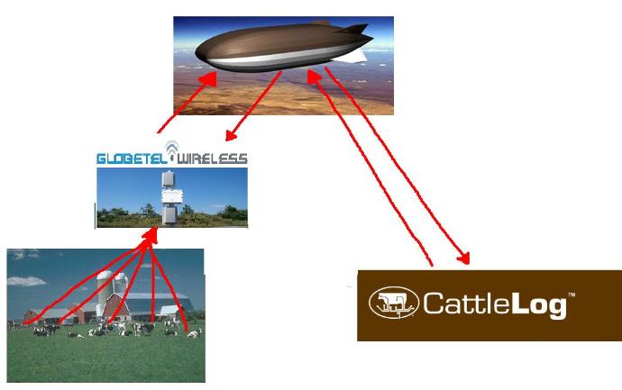
A Stratellite™ is a high-altitude airship that when in place
in the stratosphere will provide a stationary platform for
transmitting various types of wireless communications
services currently transmitted from cell towers and
satellites. It is not a balloon or a blimp. It is a high-altitude
airship.
Made of Space age Materials and powered by solar
powered electrical engines, each Stratellite will reach its
final altitude by utilizing proprietary lifting gas technology.
Once in place at 65,000 feet (approx. 13 miles) and
safely above the jet stream, each Stratellite will remain in
one GPS coordinate, providing the ideal wireless
transmission platform. The Stratellites are unmanned
airships and will be monitored from the Company's
Operation Centers on the ground.
A Stratellite will have a payload capacity of several
thousand pounds and clear line-of-sight to approximately
300,000 square miles, an area roughly the size of Texas .
The Stratellite is similar to a satellite in concept, but is
stationed in the stratosphere rather than in orbit. Existing
satellites provide easy "download" capabilities, but
because of their high altitude are not practical for
commercially viable "two-way" high-speed data
communication. The Stratellite will allow subscribers to
easily communicate in "both directions" using readily
available wireless devices.
Once the US National Wireless Broadband Network is
completed, Sanswire will be able to provide voice, video,
and broadband Internet access to all parts of the country.


| eMerge (EMRG) Method of Business |
| My Method of Business |
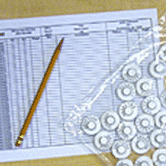
STEP ONE:
Call CattleLog and order
EID tags and customized
worksheets
Call CattleLog and order
EID tags and customized
worksheets
STEP ONE:
Call CattleLog and order
EID tags and customized
worksheets
Call CattleLog and order
EID tags and customized
worksheets
STEP TWO:
CattleLog ships EID tags
and worksheets to you
CattleLog ships EID tags
and worksheets to you
STEP TWO:
CattleLog ships RFID
tags to you
CattleLog ships RFID
tags to you
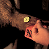
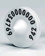
STEP THREE:
Apply EID tags in left ear
while processing cattle
Apply EID tags in left ear
while processing cattle
STEP THREE:
Apply RFID tags in left
ear while processing
cattle
Apply RFID tags in left
ear while processing
cattle
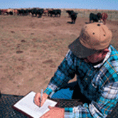
STEP FOUR:
Write down processing
information and
individual animal
information such as
weights and visual tag
numbers
Write down processing
information and
individual animal
information such as
weights and visual tag
numbers
STEP FOUR:
Technician places a
Hotzone wireless
antenna near cattle
barn, similar to a DSS
dish.
Technician places a
Hotzone wireless
antenna near cattle
barn, similar to a DSS
dish.

STEP FIVE:
Mail or fax worksheets
back to CattleLog for
entry into CattleLog
database
Mail or fax worksheets
back to CattleLog for
entry into CattleLog
database

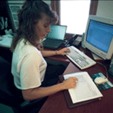
Real-Time information is
at the finger tips of the
farmer at any location on
their farm, town, or
hundreds of miles away!
My process eliminates all complicated worksheets, data entry, mailing or faxing information. My process gives
real-time data back to the farmer without any headaches. With the proper access codes the farmer would be
able to access real-time data on all their livestock anywhere there is Internet.
real-time data back to the farmer without any headaches. With the proper access codes the farmer would be
able to access real-time data on all their livestock anywhere there is Internet.
| Matthew's GlobeTel Website , Matthew's Home Website , Contact Me |

| First STRATellite Prototype 1/3 the actual size |